Saturday, June 30, 2007

AK Trip - Day Fifteen - Saturday, June 30th,

The James W. Dalton Highway
aka
The Haul Road

Well, we finally decided The Haul Road was too good an opportunity to miss.

But first, for those unaware, let me explain a little about The Haul Road. The James W. Dalton Highway is a four hundred plus mile, commercial, gravel/dirt, pipeline-service road built by and for the Prudhoe Bay oilfields at a cost of $150 million dollars. Hence the nickname The Haul Road. It is now a public road after being turned over to the state of Alaska by the oil consortium Aleskya a few years ago.


The pipe line snakes alongside The Haul Road.

We left Fairbanks with the intention of riding the 350 mile round trip to The Arctic Circle. The first 65 miles is a patchwork of pavement laced with frost heaves, gravel patches and potholes. The last gas stop is a place called Hilltop, 20 miles north of Fairbanks. After Hilltop the next gas available is a hundred nine miles north at the Yukon River.

When you see this sign you are out of pavement and up to your elbows in gravel and dirt. I was surprised at how mountainous the road was. It is a constant up and down ride. The steep grades are designed for the mammoth semi trucks that dominate the road. I regularly saw semi’s today sporting 34 wheels. When one of these monsters passes you, either way, you are completely blinded by the resulting dust storm and pelted by flying rocks.

Another difficulty riding this road included the water trucks spraying a sulfate solution to harden the surface. This mixture made the gravel/dirt as slick as glass and downright soupy in places. We encountered one very bad section a couple of miles long.

Yet another problem occured when we topped a mountain and found the road completely torn up for twelve miles by construction crews. They had just laid down a carpet of fist to cantelope size boulders as a base for the new road. These rocks almost proved our undoing as we tried to negotiate through them. At one point I saw Ted almost lose his Wing as it lunged sideways and I radioed to ask "Is this the point where we decide to turn around?" LOL


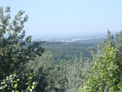
The unspoiled vastness is overwhelming!

It is still spring this far north.

The Yukon River Bridge
A wooden plank-deck bridge over a half mile wide river with huge holes in it everywhere.

We continued on though and made it to The Yukon River gas station. Unfortunately, the station was out of gas and had been for over a week. Just a few miles up the road was another station called The Hot Spot. We were told this station was out of gas also.

This posed a huge problem. We had enough gas to go on to The Arctic Circle but, if we did, we would not have enough to make the return trip to Fairbanks. The only other option was to continue on to Coldfoot, another 160 miles or so up the road. Neither of us ever had any intention of riding to Coldfoot. So, after wolfing down a burger and buying the T shirt, we returned back down The Haul Road with a mean little thunderstorm chasing our every move.

After successfully re-negotiating the much dreded construction section, we finally made it back to the paved road. Well, what passed for paved.

Our last adventure for the day happened when Ted hit a frost heave too hard and bounced completely out of his seat, landing on his backrest and breaking off the right driver foot peg. I thought for sure he had lost it. All worked out well in the end. Nothing else was broken and we will now be on the hunt for a replacement peg either here or in Anchorage.

Two side notes;
We have now ridden 5300 or so miles.

That mean little thunderstorm finally caught up with us. It is pouring outside as I write this.

Tomorrow we pack up and head south for Denali. The fun continues!

"If you never did, you should.These things are fun, and fun is good." ~Dr. Seuss~

Friday, June 29, 2007

AK Trip - Day Fourteen - Friday, June 29th,

Fairbanks, AK

Fairbanks as seen from The Steese Hwy to the north.

After thirteen non-stop, three to five hundred mile riding days, this day has been declared a day of rest. Well, almost. Our plans for today include washing laundry, cleaning up some very dirty bikes and hopefully some time to rest as well. We might even find some time to sight see a bit.

Here I should explain a bit about time changes. Since we left home we have crossed three time zones, which means we are now three hours behind Central Standard Time. To illustrate how this has affected us I need only to say we both went to bed last night with the goal of sleeping in this morning. I woke up and asked Ted what time it was only to hear him say 3:50 am. In all fairness our internal clocks still read CST or 6:50 am, very late to sleep in for either one of us. We quickly learned to change to the local times as we go. It is too confusing not too. It’s a pity our internal clocks will not follow the plan as well. Additionally the sun rise and set is playing a big factor in our time problems as well. Today the sun rose at 3:07 am and will set at 12:57 am tomorrow morning. That's a grand total of two hours of semi darkness.

Downtown Fairbanks Monument to the Eskimo's


Another item on the agenda today is the Alaskan Ferry system. Ted and I have decided to do some research regarding the ferry routes and the fee’s. We both would like to include a short ferry ride of some kind in this trip. We will be handicapped because we have not made long term reservations and the ferries are usually booked far in advance. We are hearing motorcycles can sometimes get squeezed on at the last minute. It’s worth looking into.

Ferry Update: It turns out the Alaska Ferry does not run where we need to go on an acceptable date. It would not matter though since it is booked solid through July and August.

Sometime today we will have to make the decision whether to make a run up to The Artic Circle on the Haul Road. The weather is fine. The only issue is have we had enough gravel to suit us already.

By the way, it never hurt to let you guys know how much we both appreciate your comments and e-mail. Keep em coming.


The Alaskan Pipe Line Visitors Center

The Aleyska (Alaskan) Pipe Line - 820 Miles Long
Notice the fins on top of the pipeline. Used to moderate the pipe temps.

"Anyone who lives within his means suffers from a lack of imagination." ~Lionel Stander~

Thursday, June 28, 2007

AK Trip - Day Thirteen - Thursday, June 28th,

Today was another beautiful day to ride. The temps started at 36 degrees but rose to the low seventies.

Yesterday we were so worn out from all the rough riding we both crashed early. Early to bed meant we both woke up early. So early we had to wait for a gas station to open before we could leave Beaver Creek.

We left Beaver Creek around 6:00 am and soon crossed the border into Alaska proper above the 60th parallel. The miserable roads of yesterday soon disappeared and we had smooth sailing from there on. That’s not to say Alaska does not have its share of frost heaves and gravel patches… It does. But at least they do repair them and gravel sections are measured in yards, not miles.


Alaska has many roadside pull offs with detailed explanations of what you are seeing.
A hundred and ten miles later we arrived in Tok, AK where we had a great breakfast at the legendary Fast Eddy’s. The next stop on the ALCAN was Delta Junction, another 110 miles up the road. Somehow it seems like everything on this highway is 110 miles up the road.
We've seen a lot of game along the way. This cow moose was grazing in a small pond along side the highway. We also had a cow with a small calf cross directly in front of us today.

We also stopped at the "Official" North Pole along the way. No.... we didn't make any special requests due to our less than stelar behavior of late...

We are in Fairbanks, AK tonight. We cancelled our reservations at the FE Gold camp, preferring to be in town close to better restaurants and Wi Fi service. We have officially ridden the entire 1488 miles of the Alaska Highway.

It’s nice to be back in the land of dollars and cents. Ted and I both had a time getting use to Loonies (one dollar coins) and Toonies (two dollar coins). More times than not we would both stand there with a dumb look on our face while some clerk dug around in our outstretched hand to find what she needed. All in all, their system works pretty well. They have no one dollar bill, preferring to deal in coins for anything under $5.00.

There were also other areas that required getting use to. Such as kilometers, liters and temperature. Kilometers were pretty easy to figure out since both bikes have both mph and km's on the speedometer. We still have not figured out how many liters are in a gallon and it's probably just as well, considering the high price of gasoline. In trying to figure out how to dress for the next day, we would watch the nightly news. We would see something like 10 centigrade and have to figure out a formula to convert it to Fahrenheit. Our shortcut method would be to multiply the ten by two and add 32 to come up with 52 degrees Fahrenheit.

Another story worth noting is Ted’s innocent habit of letting me lead the way through border crossings. It has become apparent that I am always up front, passport in hand, getting grilled. When I have satisfied the guards up rolls ole Ted, with nothing but his drivers license in hand, which seems to work well once the guard determines he is riding with me. He screwed up at the Skagway crossing though. There he had his American Express card ready for the Canadian guard. The guard got a kick out of it and told him "Don't leave home without it." LOL
"To those who can dream there is no such place as faraway." ~Anonymous~

AK Trip - Day Twelve - Wednesday, June 27th,

Whitehorse YT to Beaver Creek, YT


Today we left our motel in Whitehorse YT and headed north with the goal of reaching the US / Canadian border at Beaver Creek, YT.

A pretty simple (read easy) plan you’d think….. only 279 miles. As it turned out the Yukon Highway Dept had other plans in store for us…. but …..wait….. I’m getting ahead of myself.

Our second goal for the day was to visit Kluane National Park. Kluane NP is a beautiful mountain range that separates the Canadian plains we are riding in from the southeast coast of Alaska. Our route takes us parallel to these mountains and north to the border.
The visitor center at Kluane National Park

Some of the better gravel we rode today. Miles and miles of it!
Kluane Lake
When you see one of these... You better be paying attention!

Today’s roads turned out to be a disaster! More than 200 miles were dirt, gravel, washboard or simply non-existent! Speeds were reduced at times to less than 20 miles per hour due to the dust and deep squirrelly gravel. I talked to one unhappy RV'er who had to stop and clean up his camper after he shook everything out of his galley cabinets onto the floor, including the shelves, doing 10 mph.

We have also learned the true meaning of Hoyt Knoth's term "whoop-tee-doo's". Frost heaves have torn up the road beyond belief. Canada simply plants a flag beside the spot and leaves it up to you to neogiate it. The heave may run across the road or it may run with the road. You won't know which until you're in it. I once commented to Ted I could see the undercarriage of his Wing on one of his bounces.

Suffice it to say you won't want to hit a frost heave at any speed.

Our motel in Beaver Creek was a three room affair above a general store and pub. Aside from not having Internet or a phone in the room it wasn't half bad. You could easily have slept 6 in the room and the bed was the best of the trip to date.


We finally ended the day in Beaver Creek, YT, the most westerly community in Canada. Tomorrow we cross back into Alaska on our way to Fairbanks. Oddly enough, most people don't realize just how big Canada is or how long it takes to cross it. We will finally reach Alaska after 13 days riding, the majority of which will have been done in Canada.

For Don U:
So far we have not resorted to road kill. (as I sit here eating strawberry pie... LOL)

Our normal day consists of eating the contentinal breakfast in most hotels before we leave for the day. Sometime around mid to late morning we stop for a break and we may or may not eat something. Generally we stop to eat just before we go to the motel, perfering to have everything done when we get there. We've eaten our share of burgers and sandwiches but we've also had steak one night and a great pasta meal in Ft Nelson. We've also managed to buy snacks for the evening so we won't be deprived... LOL

I once thought I would lose weight on this trip but that's not happening.
"Pay no attention to what the critics say; no statue has ever been erected to a critic." ~Jean Sibelius~

Tuesday, June 26, 2007

AK Trip - Day Eleven - Tuesday, June 26th,

Watson Lake to Whitehorse, Yukon Territory
with a side trip to
Skagway, Alaska


The original plan for today was a ride up the Alaska Highway to Whitehorse. Remember, towns in this part of the world are few and far between. If you intend to stay in motels and you don’t want to ride 6 to 8 hundred miles a day, you sometimes have shorter days than others to make that accommodation. Such was the case today. Ted and I decided to make the best of the short mileage day by adding a side trip to Skagway, Alaska for the Yukon Gold Rush NP stamp.

When the day was all done we rode 460 miles and had a great day. I guess it is obvious Ted and I are becoming more and more accustomed to longer mileage days on a daily basis. The key word is "daily." I expect that to only improve.

The temps stayed in the mid 50’s and we had no rain. We did have to deal with about 40 miles of gravel and road construction.

The Teslin Bridge - Alaska Highway
The fifth open, metal grated deck bridge we've encountered and the longest.


Klondike Highway - On the way to Skagway.
The Klondike Highway is mountainous and covered in snow.
It is just ending spring here with many flowers still in bloom.

In the north you are not allowed to cross a construction zone on your own. You wait for a Pilot Car to lead the way.
US Customs - Re-entering the US

Four cruise ships were docked at Skagway.

All is well to date. We are riding to Beaver Creek, Yukon tomorrow. Fairbanks Thursday.
"You don’t get harmony when everybody sings the same note." ~Doug Floyd~

Monday, June 25, 2007

AK Trip - Day Ten - Monday, June 25th,

Fort Nelson, British Colombia to Watson Lake, Yukon Territory

Leaving Fort Nelson we were headed for Watson Lake, 335 miles away. We got up to 41-degree temps and a relentless cold rain. It is a steady climb up into the fog filled mountains that separate British Colombia from The Yukon Territory. We made up our mind to slow it down to 50 mph and work our way over the mountains. All in all it was a nice ride, even if it did take quiet a bit longer. It is safe to assume we are both glad we brought warm rain gear.


We ate lunch and rested at Toad River.
We saw numerous herds of wild buffalo directly along side the highway along with deer, caribou, sheep and another huge moose cow.
The Liard River
The Liard River runs north from British Colombia into The Yukon Territory. We followed it down out of the mountains and into Watson Lake.


Welcome to The Yukon Territory!
Watson Lake - Sign Post Forest
The legend says a traveler nailed a hometown sign to a post at the intersection of the Alaskan Highway and The Campbell Highway. The Sign Post Forest now contains in excess of 8,000 signs.
Michelle, notice the sign in the middle up at the top. Have you beat me here? LOL

Tonight we are staying in a very unique motel. The room has no in room phone, no bathroom or shower (communal), and we had to request a 12" tv. Oddly enough, it does have Wi Fi. Carolyn I'll call tomorrow.

A word about the Alaska Highway. If you are like me, you have heard all the horror stories about what this road is like. I have found it to be odd, to put it mildly. Much of the highway would be comparable to any US state highway, meaning two lanes, with a reasonably smooth surface. However, more than a little dwindles down to a poor county highway, with sections torn up and large gravel sections. By large I mean you will be running along at speed and encounter a hundred-yard section of unannounced gravel. We have also seen a lot of construction but have had little trouble negotiating them. To this point we have crossed 4 metal deck bridges. More on this highway as we see what the Alaska portion looks like.

Tomorrow
we are off for Whitehorse, Yukon Territory.


"Yesterday is history. Tomorrow is a mystery. And today? Today
is a gift. That's why we call it The Present."~Babatunde Olatunji~

Sunday, June 24, 2007

AK Trip - Day Nine - Sunday, June 24th,

Dawson Creek, BC to Fort Nelson, BC

Today we paid the piper for all the previous good weather we have enjoyed. Ted says "Into every ride a little rain must fall." I guess he's right.

We left Dawson Creek early with Fort Nelson as the goal. The temps were in the low 40’s and the sky loomed dark and heavy to the north. About a hundred miles out of Dawson Creek the drizzle started and continued for the next 130 miles. The temps never rose above the 40’s while it rained. About 60 miles out of Fort Nelson the rain let up and the temps rose to the 50’s. Nothing feels better than riding out of a cold rain into the warming sunshine.

Taking a break on the Alaska Highway.
Don't look for anything other than rain and trees.... I remain in awe at the vastness of the far north.


We also encountered construction near Pink Mountain, just before the rain started, which led to an 8 mile gravel ride. I find it interesting how they simply remove all the pavement for miles before they start repaving. It was mostly light gravel and not much of a problem riding.

People have constantly asked me how do you attempt a ride like the one we are doing. I have always liked the comparison of eating an elephant. You do it one bite at a time. Well, if that's true, today's bite was wet and tough..... LOL

On another note; I tipped the V Strom over in the motel parking lot this morning. Since Kevin P. and I lowered the bike it appears the side stand is a bit tall and the bike has a real tendency to fall over to the right. I was lucky, no one was hurt and all it did was crack the right blinker. That blinker was damaged from a previous ride anyway so a little duct tape fixed the problem until I return. I am glad I didn't replace it before I left.

It looks like I may need to redo the tape tomorrow.

Tomorrow we are off to Watson Lake and the sign post forest. Hopefully we will enjoy some fair skies for the ride. Right now that's doubtful... It's raining outside as I type this.

For Mike J: We both appreciate and enjoy some of the short days. The only way we could continue a ride of this magnatude is with some built in easy days.

Photo's were scarce today due to the rain and the lack of different scenery.

"It is not down on any map. True places never are."
~Herman Melville~